A snowstorm on Sunday into Monday blanketed most of the state in varying degrees, and snow is still falling in parts of the state on Monday morning.
The National Weather Service said in a message on X, formerly known as Twitter on Monday morning that rain showers will change into snow showers in portions of the state, particularly in the southeast.
The heaviest snow appears to be centered around Brockton and encompassing parts of Routes 24 and 3 south of Boston, with between 2 and 3 inches of snow predicted on Monday — potentially lingering into the afternoon and evening in spots.
Snow will end this morning across the interior of the state with generally 1 inch or less left to go, according to the National Weather Service.
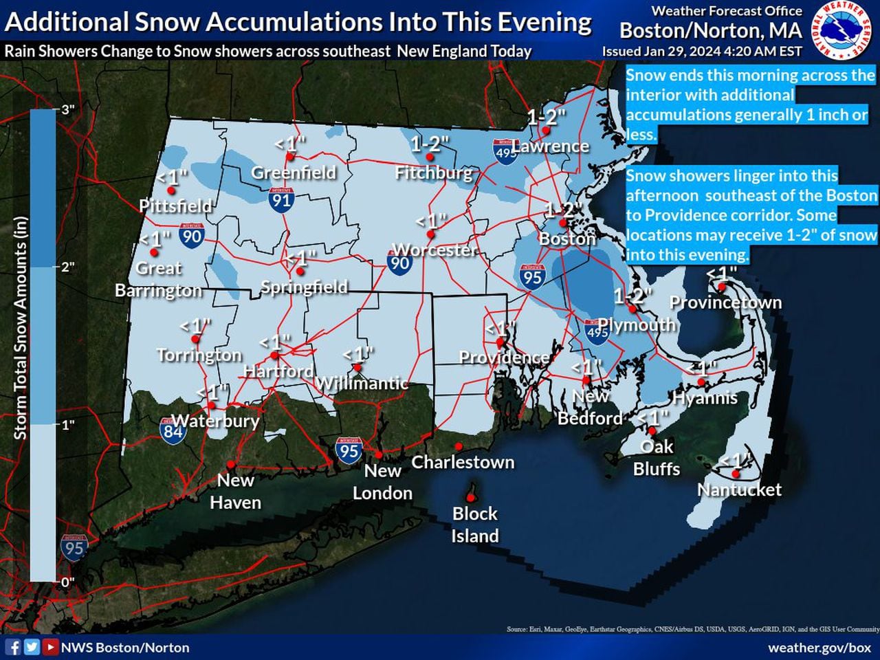
The National Weather Service predicts continued snow in certain portions of the state on Monday. (National Weather Service map)National Weather Service map
Snow has potential to fall in the Brockton area through 8 a.m. Tuesday, according to predictions by the National Weather Service.
For Western and Central Massachusetts, snow should already be tapering off and ending.
In the northeastern part of the state, the Lawrence region may have snow through 10 a.m. About 1 to 2 more inches of accumulation is expected, the Weather Service predicts.