
Wednesday’s weather is a good reminder that Valentine’s Day takes place in the dead of winter. It will be cold and windy in Massachusetts, and snow is on the way, according to the National Weather Service.
While the storm will be weaker and quicker than the nor’easter on Tuesday, which dropped heavy snow on southern Worcester County, south Eastern Massachusetts and the Cape and Islands, much of the state will actually see more snow from the upcoming storm, said Kristie Smith, a National Weather Service meteorologist based in Norton.
Snow should start falling in Western Massachusetts at 9 to 10 p.m. on Thursday night and 11 p.m. in the Boston area, and be done by 2 or 3 in the morning, Smith said.
“It’s a very manageable system,” she said.
While southern and coastal areas of the state saw more snow on Tuesday, it is the northern areas that will see more snow for the Thursday-Friday storm, though Smith said a modest 2 inches is what should be expected in many areas.
Still, that’s more than a lot of communities got on Tuesday. While snow was heavy in some portions of the state, large swaths of the state in the north that usually see decent snowfall totals saw either nothing or hardly anything.
A National Weather Service map released Tuesday evening shows the areas where the most snow fell, based on observations by weather observers.
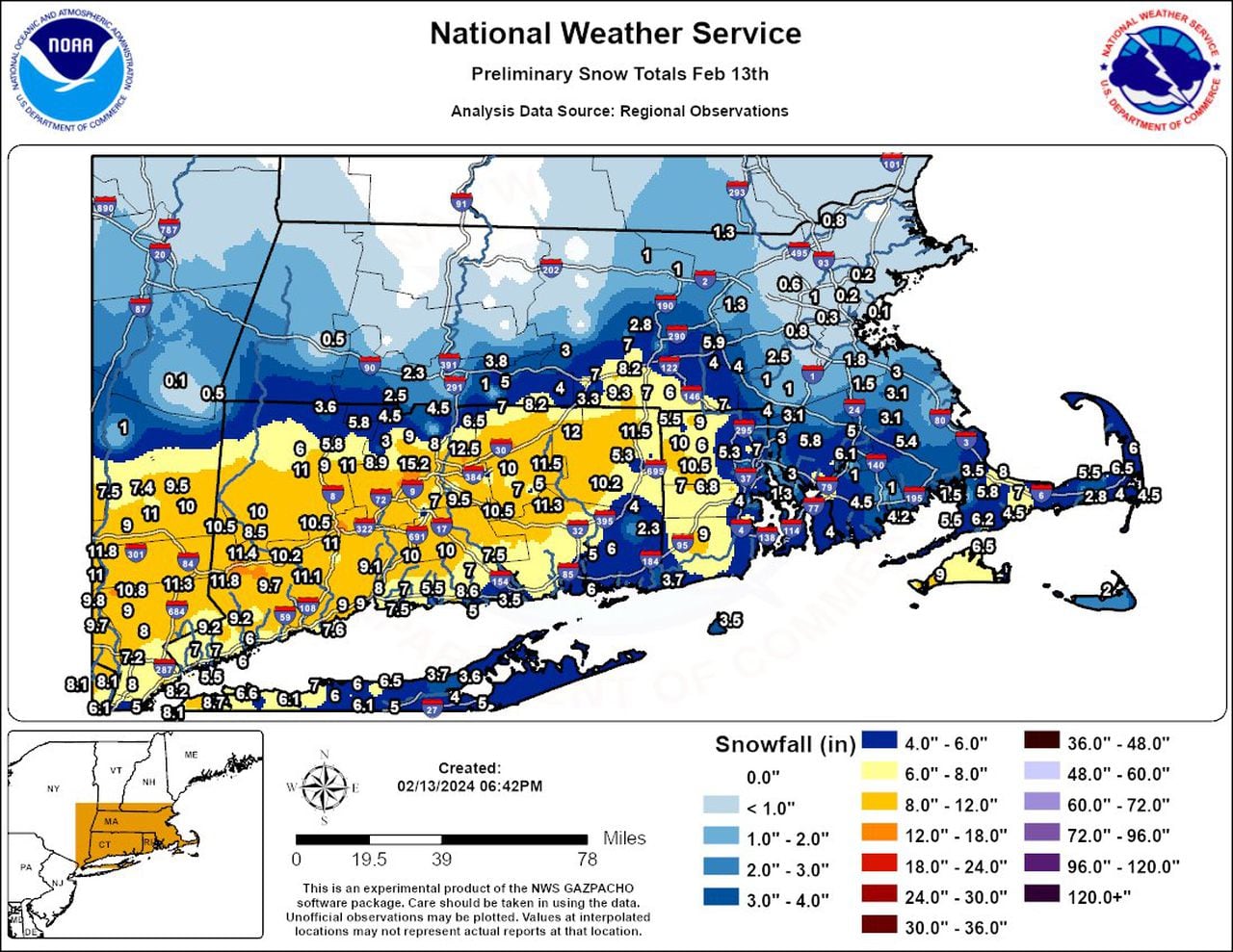
A National Weather Service snowfall total map shows that while Connecticut took the brunt of Tuesday’s storm, Massachusetts largely missed out on the highest snowfall. (National Weather Service graphic)National Weather Service graphic
The heaviest snow was reserved for the southern and eastern portions of the state, while most communities in the north got hardly anything.
A cold and windy Valentine’s Day
Temperatures across Massachusetts will be bitter cold on Wednesday, with wind chill dropping how it feels to be even colder.
Winds will be between 25 and 40 mph across the state, the National Weather Service reported. Wind chill will drop temperatures down into the teens for most of the state.
The Berkshires and north Central Massachusetts will see the worst cold, with some wind chills dropping to less than 10 degrees, according to a National Weather Service wind chill map released Wednesday.
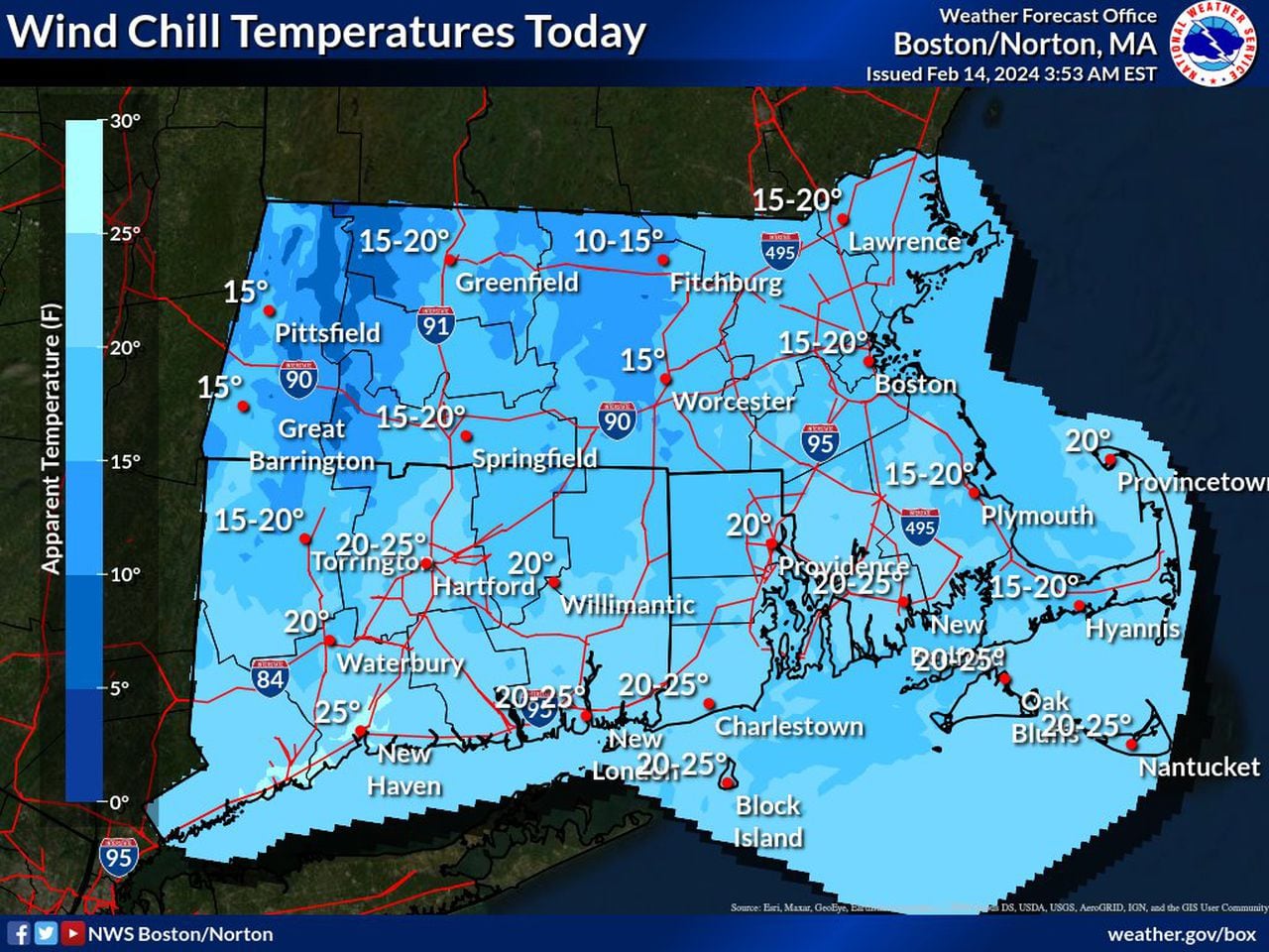
Wind chill values will be mostly between 15 and 20 degrees in Massachusetts on Valentine’s Day. (National Weather Service graphic)National Weather Service graphic
Most of the state will see wind chills from 15 to 20 degrees on Wednesday. The warmest portion of the state will be southeastern Massachusetts, but only up to 20 to 25 degrees, according to the National Weather Service.
The 60-degree day the region experienced on Saturday is not likely to be repeated this month, according to Smith. Colder than average temperatures will continue through at least Sunday, with the possibility for a slight warm up at the end of February, she said.


