A temperamental storm that has been brewing in the Atlantic Ocean all last week could send some dangerous beach weather to New England this week, according to weather officials.
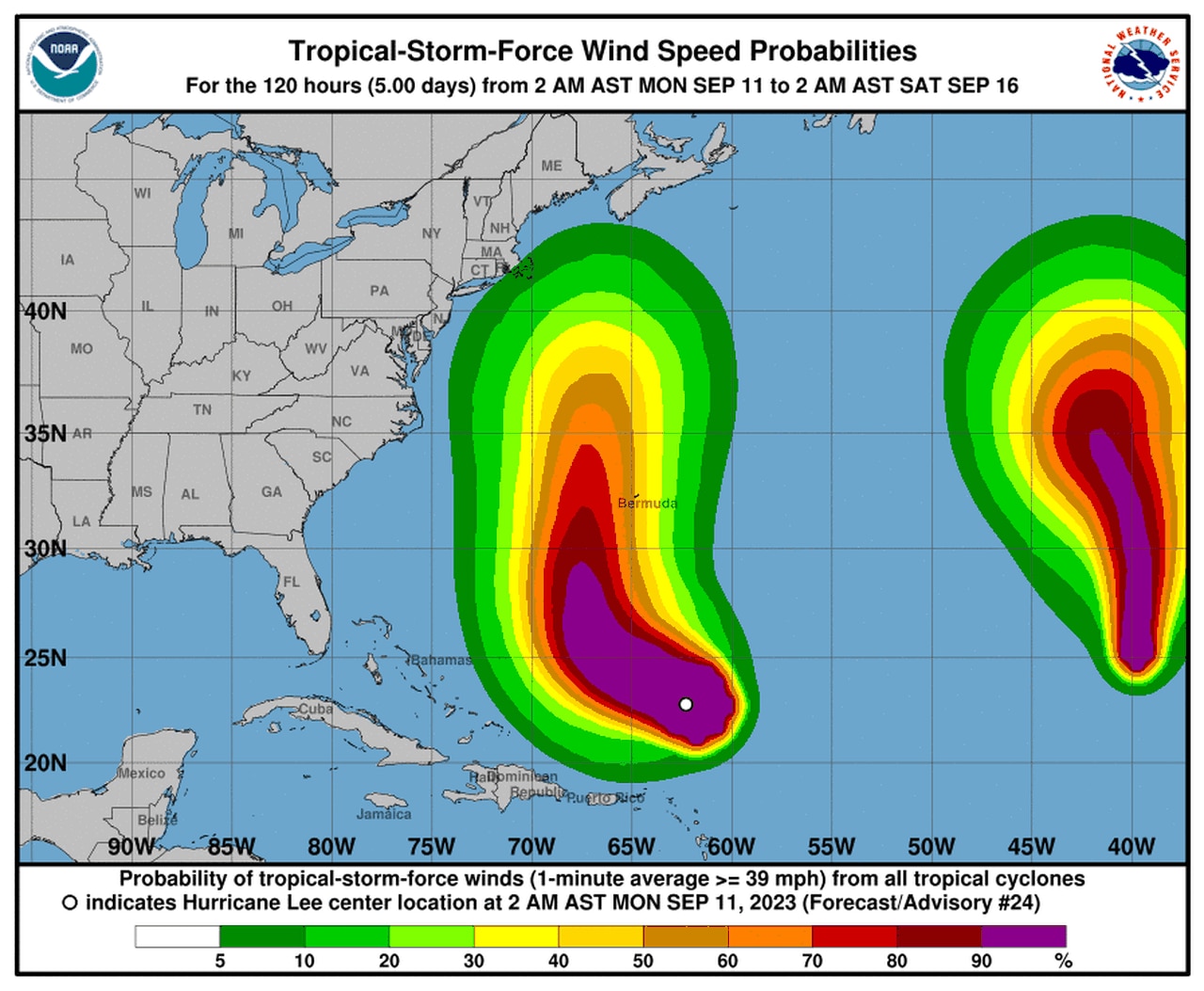
While it is too early to tell what impacts, if any, Hurricane Lee will have on Massachusetts, meteorologists are tracking the storm’s path as it heads north from the Caribbean.
The Category 3 hurricane, with winds of up to 120 mph, is currently swirling near the Leewood Islands, Virgin Islands and Puerto Rico, according to The Weather Channel.
Meteorologist Domenica Davis said the storm’s intensity has fluctuated all week, and that will continue to be the case throughout the week.
The storm has barely held onto its hurricane strength as it approached its fifth day in existence, according to WBZ-TV’s Chief Meteorologist Eric Fisher on X, formerly known as Twitter.
“Cape Cod may enter the cone of uncertainty for Lee later today,” Fisher said on Monday. “Rough surf here is a given, but whether we get rain bands/strong gusts [is to be determined.]”
Lee will pass by the west of Bermuda later this week, Davis said, but it is too early to tell how close it will come to New England. This is mostly because the hurricane is expected to slow down as it heads north, according to the National Hurricane Center’s (NHC) website.
Whether Lee makes landfall or not, dangerous surf and rip currents are expected along the East Coast starting Monday as the hurricane’s wind field extends, Davis explained.
Waves could reach heights of 10-15 feet, the meteorologist added, while the storm could bring winds of up to 39 mph to New England starting Friday morning at 8 a.m., according to the NHC.
Fisher said the Lee will get its closest to Massachusetts on Saturday as it keeps chugging toward Nova Scotia. More information about Hurricane Lee can be found on the National Hurricane Center’s website.


