
What a difference a day makes. On Monday, forecasters were calling for an epic snowstorm Tuesday across all of Massachusetts set to drop the kind of snow Boston and Worcester hadn’t seen for years. Now that Tuesday has arrived, not so much.
So what happened?
“The biggest thing that happened was the storm itself tracked further south,” said National Weather Service meteorologist Torry Dooley on Tuesday.
As of Monday morning, the National Weather Service’s Norton office’s storm model guidance showed a storm headed directly for a point just off of Nantucket known as “the benchmark,” Dooley said.
Decades of weather forecasting has established that storms that travel over that point bring the heaviest snow to southern New England, Dooley said.
As Monday wore on, the storm, which Weather Service models originally had passing over the benchmark point, shifted further south, and continued to do so over Monday night, he said.
“Guidance for this storm in particular definitely shifted more south than what was expected,” Dooley said. “Our forecast is only as good as the model guidance we have to work with, and it really honed in on passage of a low pressure system over what we call the benchmark.”
While snow totals have dropped for the majority of the state, they are predicted to be higher than expected in south Eastern Massachusetts, particularly on Cape Cod, where 6 to 8 inches is expected.
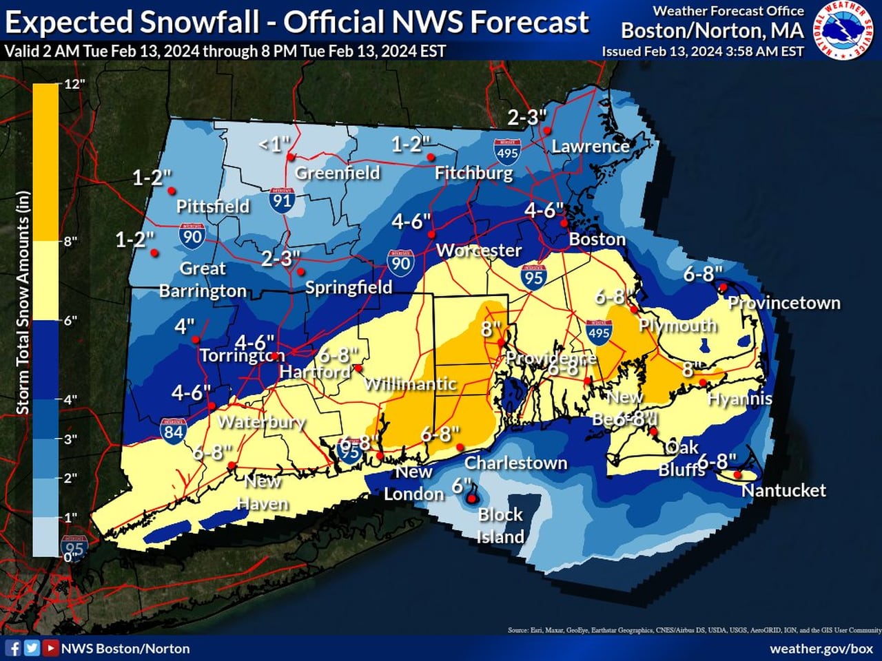
Only southeastern Massachusetts is now expected to receive more than 6 inches of snow on Tuesday, according to the National Weather Service.National Weather Service
“Unfortunately for those snow lovers further north, they are not going to cash in on as much of the snow,” Dooley said.
At least not yet.
Dooley continued that there is expected to be another snow storm this week that will affect the interior of the state and less of the coast.
While it’s too early to predict how much snow will arrive, the forecast is calling for a quick-moving storm Thursday night into Friday morning, Dooley said.


