
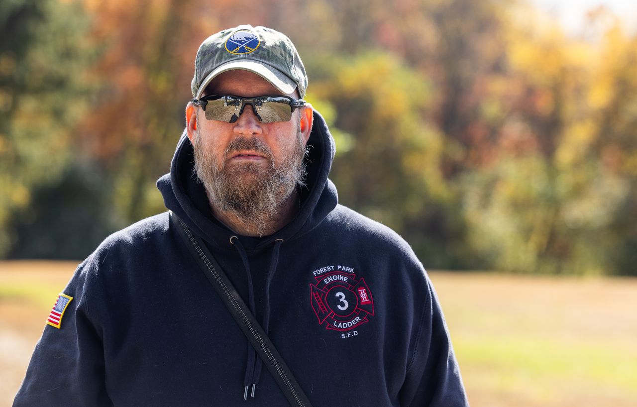
WILBRAHAM — When Rick Brohman, a retired Marine and former Springfield firefighter, started walking the trails at Fountain Park with his dog, Clay, he thought a map would help navigate the nearly 15 miles of trails that cut through the woods.
Maps served him well in combat during Operation Desert Storm in 1991.
“I was a grunt in the Marine Corps,” said the Palmer resident. “Land navigation is everything when you’re in combat. You always have to know where you are.”
Brohman, 55, and Clay — a German shepherd and Great Pyrenees mix — walk the trails a half-dozen times a week, and what they witness is astounding.
“I have seen pheasants fly up in front of me. There are all kinds of beautiful birds, along with squirrels and chipmunks,” he said.
Fountain Park was created more than a century ago, founded as a state-run game farm. Vestiges of foundations and fencing are hidden along the trails. The 144-acre preserve on Tinkham Road — where breeders once raised pheasants — is now fondly known as the dog park, and there is a steady stream of owners that come to walk with their pooches.
“I’ll run into a lot of people when I’m on the main trails, but not when I’m on those little side trails, maybe because people don’t have the confidence or land navigation skills to use the smaller paths,” he said.
Brohman wants everyone to enjoy the beauty off the beaten paths and have the courage to explore areas unknown to them. He’s been on every trail as a walker. Now, he’s retracing his steps as a cartographer. He’s making maps so anyone can venture into every corner of the park.
“It would be nice if people understood the trail system. I’m retired. I have the time to do this, and I don’t want anyone to miss seeing what’s here,” he said.
Tracing steps
With a compass in hand and a tracking app on his phone, Brohman treks down each trail — he knows them all — and records every step he takes, each twist and turn. The program is plotting where he’s been and will generate a map when he’s done.
Ana Wells and her husband bring their three dogs to the park every day, if they can. It’s about 2 miles around the perimeter, but much longer if they traverse the serpentine trails.
“I see all kinds of wildlife and different types of trees changing color. There are so many paths interweaving with each other. You can go on a really long walk with the dogs,” she said.
Reggie Levesque and his dog, Coco, are kicking leaves aside these days, as they hike little-known trails where they pass blue spruce and juniper trees, and have come across fox holes and a gray owl. Back in the spring, they heard peepers.
“I enjoy everything about the trails,” he said. “There’s a lot to see if you know where to go, and what you’re looking at,” said the Wilbraham man.
Brohman said there is a sense of community here. For instance, some people have left tennis balls for the dogs to chase. Another person dropped off wooden patio chairs, so people can rest while the dogs roughhouse.
Brohman wants to do his part by making the maps, which he says will include a bit of history about the park.
“If I can help other dog owners, then it’s worth doing. A lot of people take the initiative to make this a better place for everyone to enjoy,” he said.
Inspired to find peace
When Brohman used maps in the Marines, he consulted them to call in coordinates for bombing raids or air support. His cause is nonviolent now. He wants people to find peace in a place that is helping him to recover from the aftershocks of war.
“I have PTSD from my service in combat. The park helps with that. I love it here. My dog loves it, too. He gets so excited when we’re here. He just goes back and forth on the trails and listens to my commands,” said Brohman.
Brohman plans to make copies of the map at a local office supply store. He’s paying for it with his own money. He said they should be displayed in a small rack, so he might make that, too. He hopes to have it all done by Thanksgiving, and that the rack can be placed at the entrance to the park.


