
After some Massachusetts communities received more than 20 inches of snow Sunday, the National Weather Service forecasters predict that periods of light to moderate snow will continue through Monday afternoon.
Areas near Boston and Lawrence are expected to get hit the hardest on Monday with up to an additional three inches, while areas in the Berkshires might only get an additional inch of snow.
Forecasters said there might be some breaks in snowfall but that it could redevelop throughout the day.
A winter storm warning remains in effect until 8 p.m.
Here’s what we know about additional snowfall Monday.

Central and eastern Massachusetts could get an additional 2-3 inches, while Western Massachusetts could get an additional inch of snow.
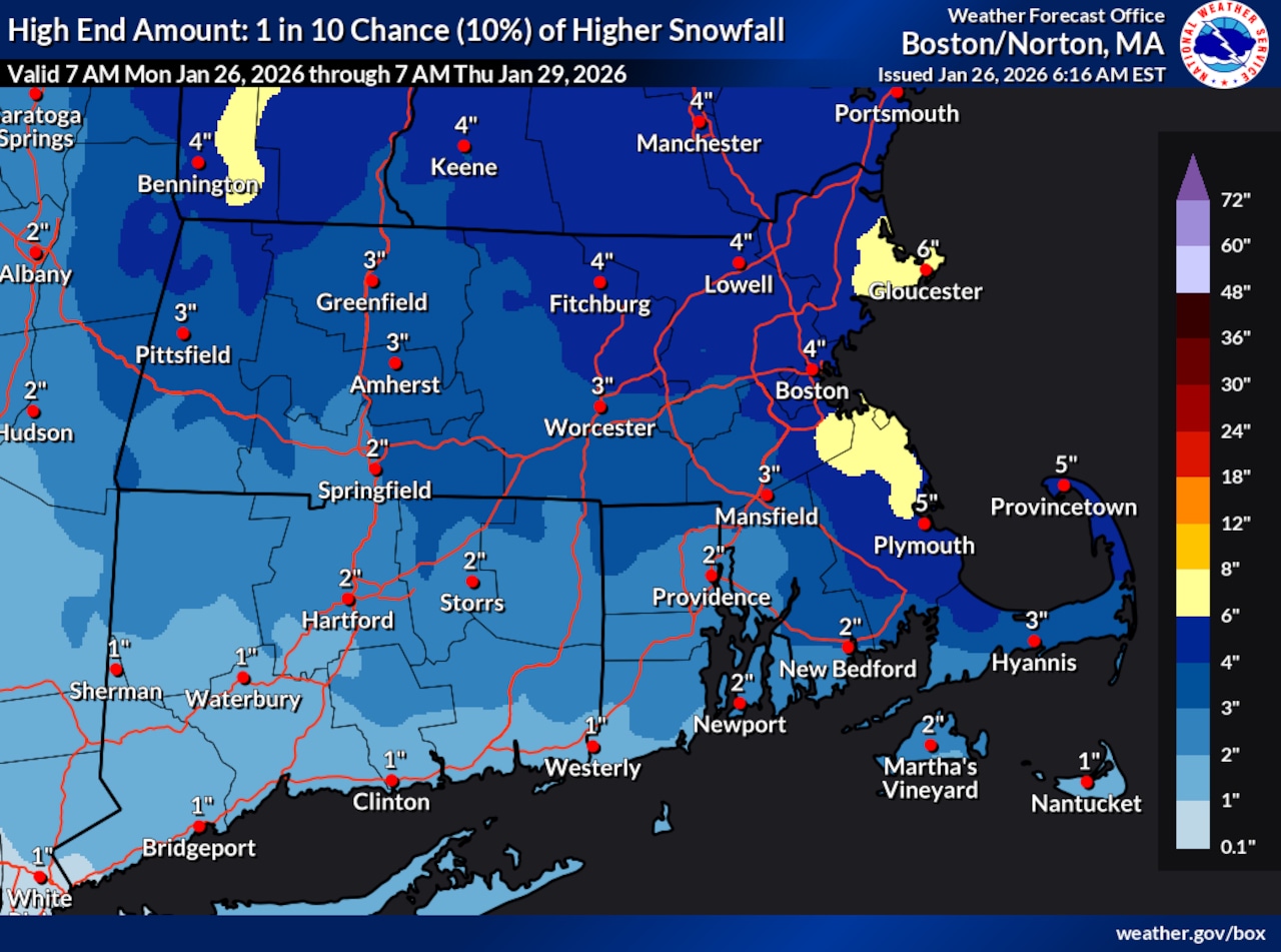
There is a small chance Boston could get another 4 inches, Cape Cod could get five inches of snow and Gloucester could get six inches.

Ice is possible for part of the state but is more likely for communities in Connecticut.
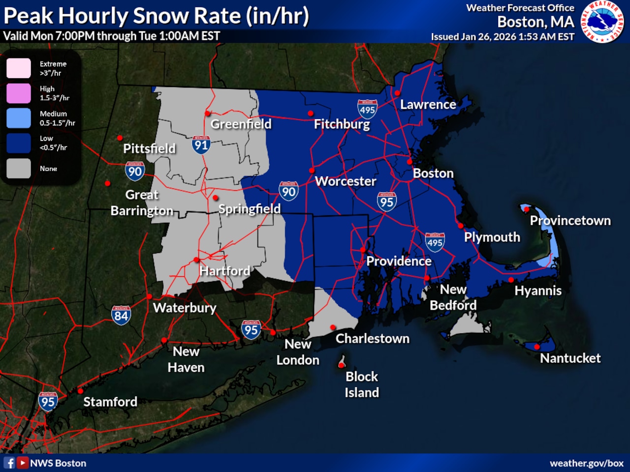
Snow could last until 1 a.m. Tuesday, especially in Central Massachusetts, Boston and Cape Cod. However, most snow will end by 7 p.m. Monday.
Monday’s storm is expected to have minor impacts to daily life. However, forecasters are still warning that drivers should be careful.


