

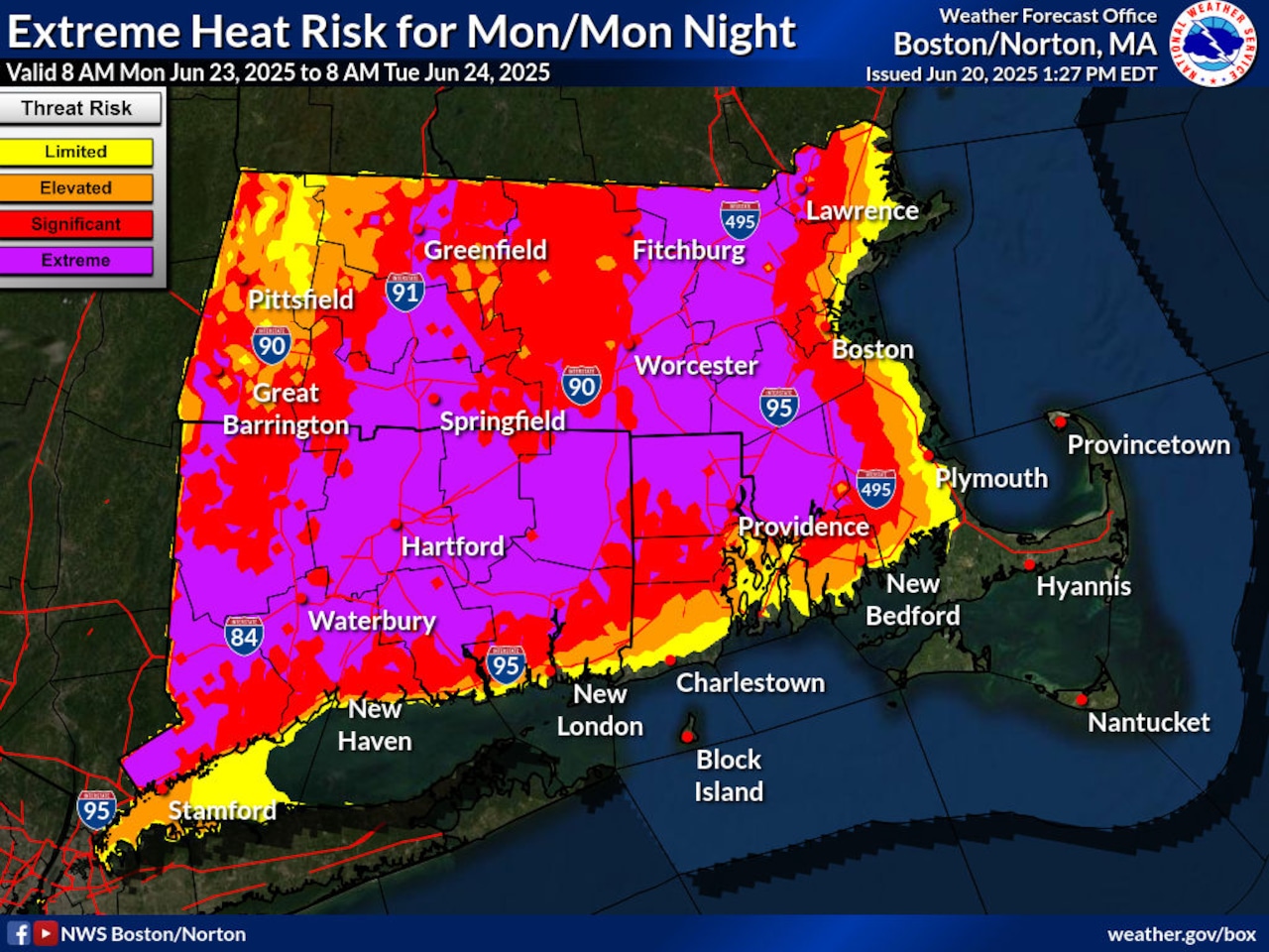
While a thunderstorm is expected to bring rain back to Massachusetts this weekend, forecasters are warning about extreme, dangerous heat that should linger starting Monday.
Daytime highs should be in the 80s on Saturday, with sunshine being very prevalent, according to the National Weather Service. While dewpoints should leave it feeling a bit warmer, it could be “nothing out of the ordinary for late June,” forecasters wrote.
The thunderstorm risk is not likely to arrive until late Saturday night and last until Sunday morning, the weather service continued. Northeastern Massachusetts could see the biggest risk with this storm, but forecasters are not sure if this storm could bring lightning and showers elsewhere across the state.
Sunday should start to see highs reach the 90s, with high humidity making it feel hotter and possibly closer to the 100s, forecasters said.
“Given the extended period of extreme heat and humidity, [we] opted to issue an Extreme Heat Watch in the Sunday-through-Tuesday timeframe,” forecasters wrote.
Over the following days, temperatures could blow past 100 degrees and feel much hotter, possibly feeling as though it’s 110 degrees due to humidity, forecasters said.
Boston’s hottest temperature between Monday and Wednesday is on Tuesday, with a high of 98 degrees, according to AccuWeather. Worcester could reach its hottest on Monday, with a high of 97. The difference is negligible for Springfield between Monday (98) and Tuesday (99).
A cold front should bring some relief again on Thursday and Friday, but forecasters warn that this is the period when another round of thunderstorms could return and drench parts of the state. However, temperatures should cool down with highs in the upper 70s or low 80s, though Springfield could see highs of 86 on Thursday and down to 82 on Friday.




