Yet another storm is headed for Massachusetts this week, bringing heavy rain and high winds. It is expected to reach the state Friday night, and the National Weather Service has already issued three weather warnings.
“This system is anticipated to usher in rain, gusty winds, and potential coastal hazards in the early hours of Saturday morning,” the weather service wrote.
A flood watch is already in effect for all of Massachusetts minus the Cape, Islands and Berkshire County, and will remain in effect until 7 p.m. Saturday. The new storm is expected to bring 1 to 2 inches of rain, on top of the 2 to 4 inches the Bay State received Tuesday night and the snowmelt from last weekend’s snowstorm.
The rain Tuesday night already led to flooded roads from overflowing rivers and streams. The weather service said the additional rain Friday night may exacerbate current river and stream flooding or result in new flooding.
“Those living in areas prone to flooding should be prepared to take action should flooding develop,” the weather service said.
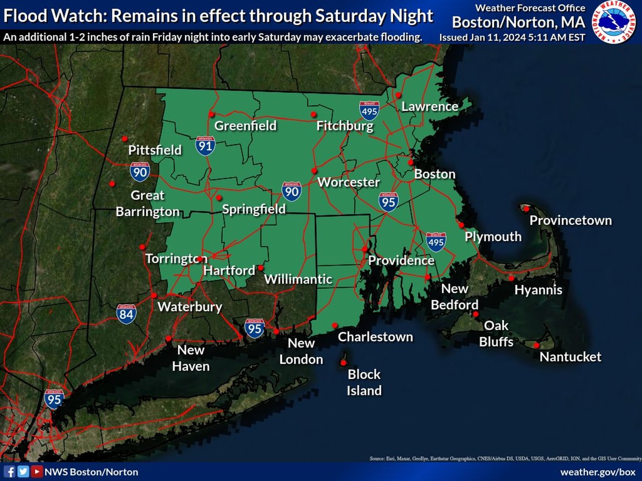
A flood watch is in effect for most of Massachusetts through Saturday evening as a result of the upcoming storm Friday night.National Weather Service
The National Weather Service has also issued a coastal flooding watch for all areas a few miles in from the Massachusetts coast from 10 a.m. to 4 p.m. Saturday. The weather service said to expect up to a foot of inundation above ground level in low-lying areas near shorelines and tidal waterways.
- Read more: ‘Not satisfied’: Sarno apologizes for lack of snow removal on Springfield streets after weekend storm
Specifically, the weather service said to watch for flooding along Morrissey Boulevard in Boston, which already flooded this week in the wake of Tuesday night’s storm. Roads will be especially vulnerable around high tide due to wave action, it said.
“If travel is required, allow extra time as some roads may be closed. Do not drive around barricades or through water of unknown depth,” the weather service wrote.
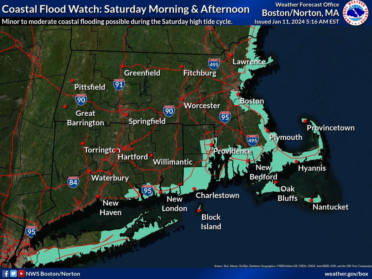
The National Weather Service has issued a coastal flood watch for all of the Massachusetts coast for much of Saturday as a result of Friday night’s upcoming storm.National Weather Service
Much of Greater Boston will also be under a high wind watch from 1 a.m. to 1 p.m. Saturday. The weather service expects southeast winds of 30 to 40 mph with gusts up to 60 mph along the Massachusetts coast, in all of Plymouth County, on the South Coast, Cape and Islands, and in northern Berkshire County.
Damaging winds could blow down trees and power lines, and power outages are possible, the weather service said. Additionally, travel could be difficult, especially for tall vehicles.
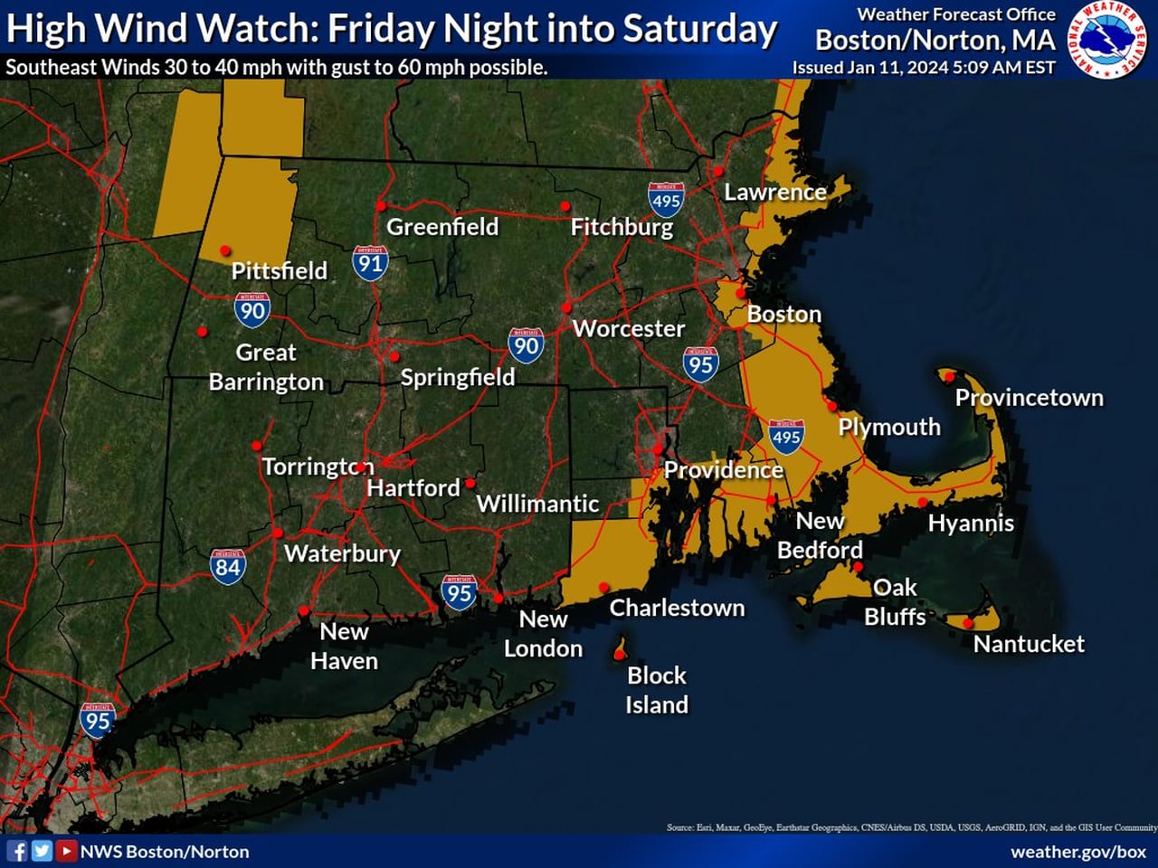
Much of Greater Boston is under a high wind watch overnight Friday and into Saturday morning as a result of Friday night’s upcoming storm.National Weather Service
The storm is expected to come in from the southwest, reaching Western and Central Massachusetts around 1 a.m. Saturday and Eastern Massachusetts around 2 a.m., according to the weather service. Higher elevations in the state could experience some snow at first, but it should turn to rain by the morning.
The rain is expected wrap up by the mid to late afternoon on Saturday, amid highs in the mid 50s, according to the weather service. The low Saturday night is predicted to reach the high 20s, leading into a chilly, breezy and clear Sunday with highs in mid 30s.
Before the storm, the weather Thursday and Friday is expected to be “relatively tranquil, with partly cloudy skies and temperatures ranging 5 to 8 degrees above the seasonal average,” according to the weather service. The highs Thursday and Friday are predicted to reach the low 40s in most of the state, while the lows overnight are expected to dip into the low 30s and high 20s.
After Friday’s storm, the next time Massachusetts may see precipitation is on Tuesday, and there is a chance of snow.