
Less than 24 hours ago, a Tuesday morning nor’easter was expected to bring some of the highest snow totals Boston and Worcester have seen in recent years. But the snowstorm shifted south Monday afternoon, drastically changing forecasters’ predictions.
The biggest changes have been in regards to the predicted snow totals and the storm timeline. Once forecasted to bring 12 to 18 inches of snow to the Boston and Worcester areas and 8 to 12 inches to most other parts of the state, now, only southeastern Massachusetts is expected to get more than 6 inches, according to the National Weather Service.
Additionally, while the storm was originally set to spread across the state by 5 a.m. Tuesday, it will only begin to reach the state around that time, according to the weather service. It isn’t expected to cover the entirely of Massachusetts until mid-morning.
The weather service canceled its winter storm warning for many parts of the state, including Boston. Suffolk County and southeast Middlesex County are now under a winter weather advisory until 7 p.m. Tuesday which predicts 3 to 5 inches of snow and a difficult morning and evening commute.
Southeastern Massachusetts up to Worcester is still under a winter storm warning which follows the same time frame and predicts 4 to 9 inches of snow.
Updated storm timeline
The storm will come in from the southwest to the northeast, likely reaching Springfield, Worcester, Boston and Foxborough between 5 and 7 a.m., weather service forecaster Bill Leatham said. Pittsfield, Fitchburg, Lawrence and Plymouth can expect to see precipitation begin between 8 and 10 a.m., while the Cape and Islands aren’t predicted to experience snowfall until after 10 a.m.
Southeastern Massachusetts could still see rapid snowfall rates of 1 to 2 inches per hour, but that’s unlikely elsewhere in the state, Leatham said. That would happen between 9 a.m. and 3 p.m.
Snowfall is expected to cease first in Western Massachusetts and northwest Worcester County between 1 and 3 p.m., according to the weather service. It is predicted to stop in eastern Massachusetts between 4 and 6 p.m., with the exception of the Cape and Nantucket, where it is expected to continue until roughly 7 to 9 p.m.
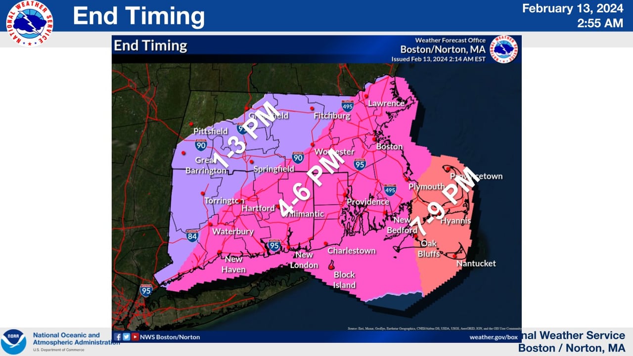
The National Weather Service expects the snowfall to begin ceasing around 1 p.m. Tuesday in the western half of Massachusetts and in the early to late evening in the eastern half.National Weather Service
Updated snow totals
Southeastern Massachusetts is now predicted to get the most snow, with only southern Plymouth County and the westernmost part of the Cape receiving 8 to 12 inches, according to the weather service. The rest of the Cape and Plymouth County, the Islands, Bristol County, southern Norfolk County and the southeastern tip of Worcester County are expected to get 6 to 8 inches.
As you go further out from southeastern Massachusetts, the predicted snow totals fall rapidly. Boston and Worcester are only expected to get 4 to 6 inches, while Lawrence and Springfield are expected to get 2 to 3 inches. Fitchburg and Pittsfield are predicted to receive 1 to 2 inches, and Greenfield is predicted to get less than an inch.
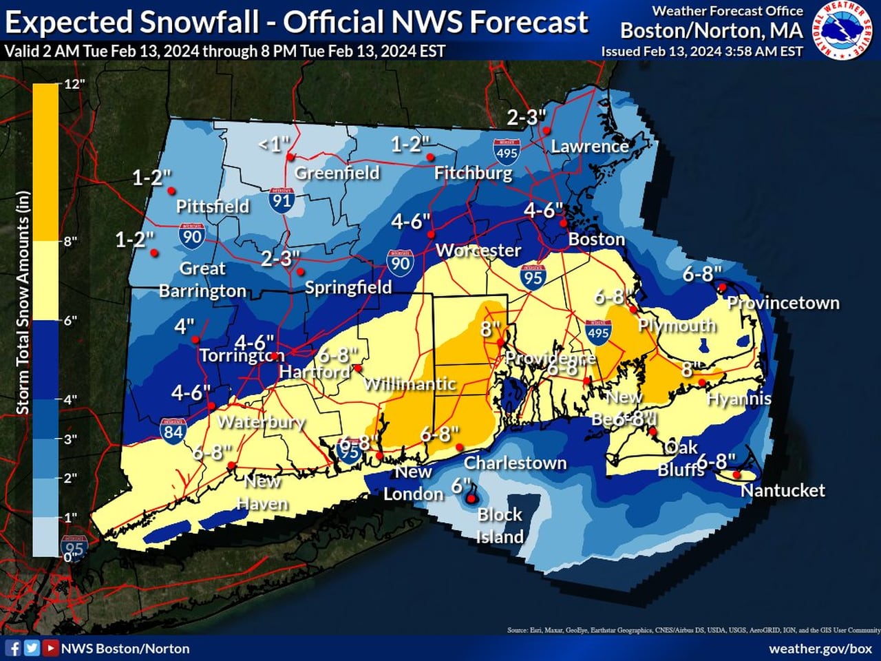
Only southeastern Massachusetts is now expected to receive more than 6 inches of snow on Tuesday, according to the National Weather Service.National Weather Service


