

Massachusetts will be covered by a blanket of snow Wednesday, with most of the state receiving several inches of accumulation.
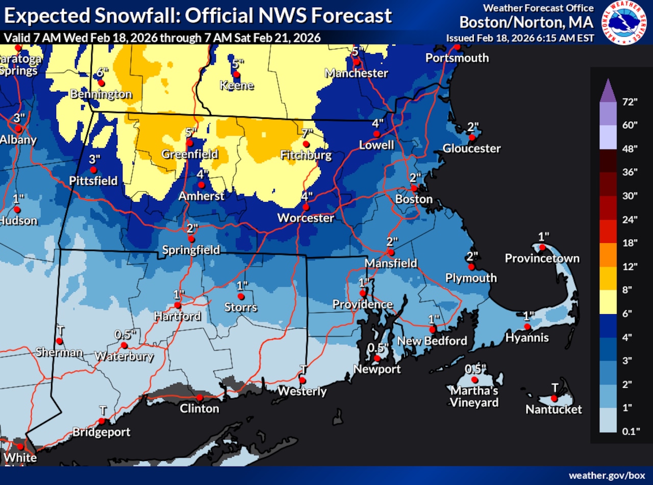
The National Weather Service has issued a Winter Weather Advisory for Central and Western Massachusetts from 1 p.m. Wednesday to 4 a.m. Thursday, as those regions are expected to receive 2 to 7 inches of snow during that window.
Rain will be falling across the state by noon Wednesday, with temperatures in the mid to high 30s. As temperatures drop, that precipitation will turn to slush, and then snow, which should continue through the evening.
The National Weather Service expects snow to begin between 2 p.m. to 4 p.m. for most of the state, and after 4 p.m. on Cape Cod & the Islands.
Current projections call for up to 7 inches in Fitchburg, 3 to 4 inches in Worcester, 2 to 3 inches in Pittsfield, 2 to 3 inches in Boston, 3 to 4 inches in Amherst, 1 to 2 inches in Springfield, 1 to 2 inches on Cape Cod and less than an inch on the Islands.
Temperatures will drop to the mid 20s overnight, and the snow is expected to cease well before the Thursday morning commute.
Thursday will bring mostly sunny skies and afternoon temperatures in the mid to upper 30s, touching 40 degrees in Western Massachusetts. As conditions cool, there is a 20% to 30% chance of freezing rain overnight.
The weekend forecast calls for a chance of more precipitation, with rain, freezing rain, wintry mix and some scattered snow possible.




