A wet start to the work week could mean flooding for parts of Massachusetts Monday, Sept. 18, according to forecasters.
A Flood Watch is in effect for the eastern portion of the state starting at 11 a.m. until late at night, the National Weather Service said on X, formerly known as Twitter.
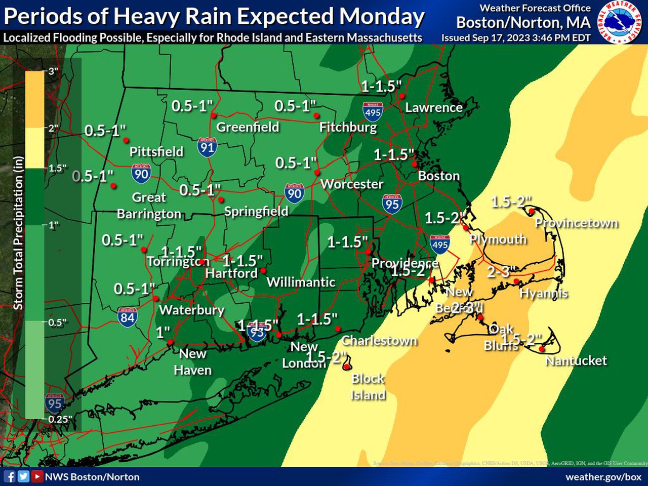
The watch applies to Middlesex, Essex, Norfolk, Plymouth, Bristol and Suffolk counties. These areas are under an elevated risk for heavy rain, according to a hazardous weather outlook map.
- Read More: Is The Big E open when it’s raining?
Periods of heavy rain throughout the day may lead to flooding of rivers, creeks, streams and other low-lying and flood-prone locations, forecasters said. Areas that got more than 7-10 inches of rain over several days last week are also more susceptible to flooding.
Most of the state could get 0.5-1.5 inches while parts of Cape Cod could get 2 inches, the weather service said. The bulk of the heavy rain as well as the chance for flooding will come in the evening. Forecasters said residents should pay attention to later forecasts and keep an eye out for possible flood warnings.
Severe thunderstorms in Massachusetts last Monday, Sept. 11, caused significant flooding across the state, dumping anywhere between 2 to 4 inches over the span of an hour in some parts of the state, according to the National Weather Service.
Parts of Worcester and Middlesex counties were especially hit hard, including Leominster. The city declared a state of emergency as some residents were asked to evacuate because because significant flooding.
North Attleborough also declared a state of emergency as more than 200 homes were flooded. The National Weather Service said Worcester could hit its yearly precipitation average with the rain on Monday.
Boston is also within 5 inches of its annual average, the weather service said on X. The dry weather makes a comeback Tuesday and lasts through Friday, forecasters said.