
Massachusetts will continue to see seasonable temperatures through the rest of the week before an arctic front brings snow showers and dangerously cold wind chills over the weekend.
High temperatures in Boston, Springfield and Cape Cod & the Islands will reach 31 degrees Wednesday afternoon, while Worcester will hit 29 degrees and Pittsfield will top out at 23 degrees. Wind gusts up to 25 mph will develop through the day before calming in the evening, according to the National Weather Service.
Boston will drop to 11 degrees overnight, and Worcester and Pittsfield will hit single digits. Springfield will plunge to minus 1.
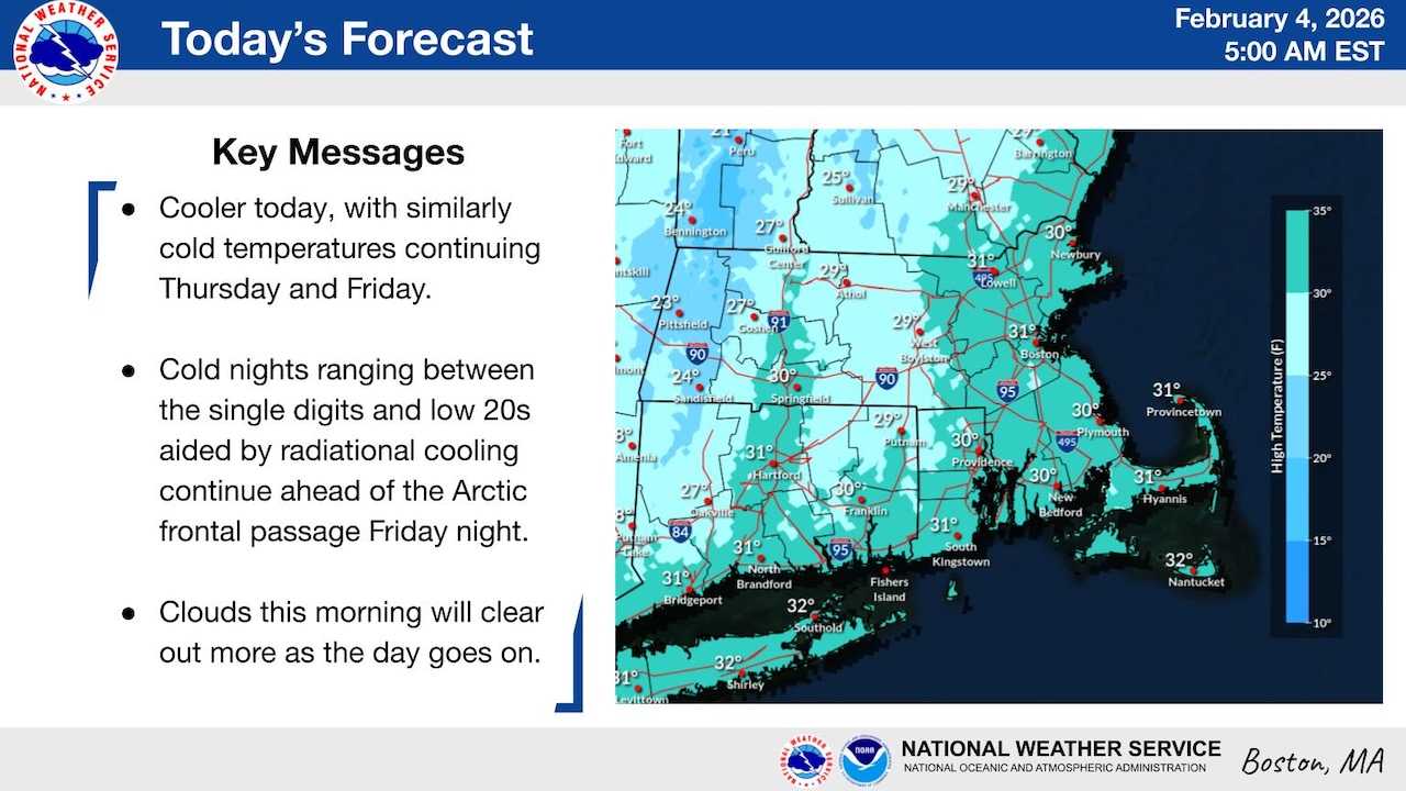
Thursday and Friday will see temperatures rebound to the high 20s to low 30s across most of the state, with snow showers moving in Friday night. Scattered snow is expected for Boston and Cape Cod & the Islands around 10 p.m., while Central and Western Massachusetts could receive a dusting beginning around 3 a.m. No significant accumulation is expected, according to the National Weather Service.
Snow could continue through Saturday as an arctic front moves in, with the National Weather Service predicting a 50% chance of snow for most of the state. Saturday night will see temperatures drop below zero in Central and Western Massachusetts, while Boston will get as cold as 2 degrees.