It’s the first weekend of spring, but the threat of snow and ice still hangs in the air.
The National Weather Service office based in Norton, Mass., is calling for heavy rain as well as snow and ice accumulation across the state.
Depending on where you are, you might see 2-3 inches of rain or up to 4 inches of snow, not to mention accumulating ice that is going to make driving a nightmare in some regions of the state.
In a statement on X, formerly known as Twitter, the National Weather Service Norton office said during the day, Friday’s weather would be “quiet,” but would become active overnight.
“We anticipate heavy rain, totals of 2-3 inches, and locally higher amounts possible,” the Weather Service wrote. “This may lead to localized poor drainage/urban flooding, as well as river flooding.”
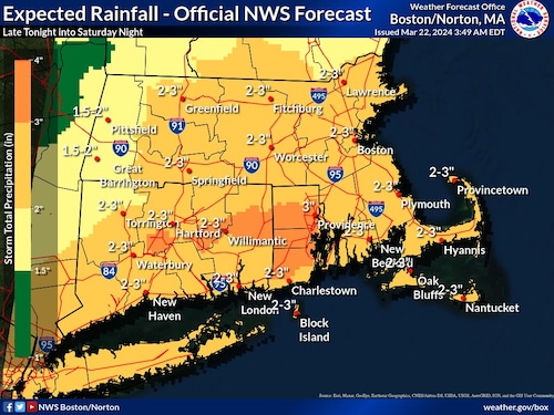
The National Weather Service calls for 2 to 3 inches of rain across most of the state Friday into Saturday. (National Weather Service graphic)National Weather Service graphic
A map of Massachusetts released by the National Weather Service shows nearly the entire state receiving between 2 and 3 inches of rain late Friday into Saturday night. Berkshire County is expected to see slightly less, with 1.5 to 2 inches of rain, according to the National Weather Service.
Additionally, another map shows the dangers of flooding across all of Eastern Massachusetts as well as in Hampden County and southern Worcester County. “Do not drive through flooded roads or underpasses,” the National Weather Service advised.
The flood watch extends to all of Connecticut and Rhode Island, as well.
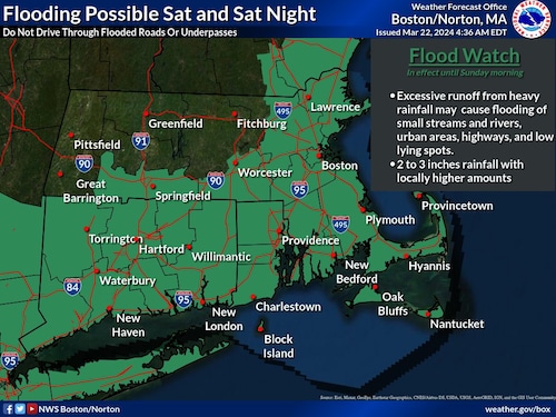
A flood watch extends across much of Massachusetts, including all of Connecticut and Rhode Island as well. (National Weather Service graphic)National Weather Service graphic
Meanwhile, a winter weather advisory is in effect from 2 a.m. to noon on Saturday, and with it comes the potential for snow and ice, especially in Western Massachusetts.
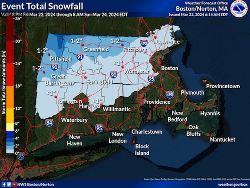
A National Weather Service map showing potential snow accumulations during a weekend storm.National Weather Service
A National Weather Service map shows Berkshire, Franklin and northern Worcester counties likely to get between 1 and 2 inches of snow, with up to 4 inches in northern Berkshire County.
A swath of the state from Springfield up through the North Shore is expected to get snow, but less than an inch. Boston, the South Shore and the Cape and Islands are not expected to get any snow.
The bigger worry than the snow across the state is the accumulating ice, according to the Weather Service. In a tweet on Friday morning, the organization released a map showing where hazardous travel conditions will persist.
Essentially, you don’t want to be driving or traveling anywhere in Western or Central Massachusetts late Friday into Saturday morning.
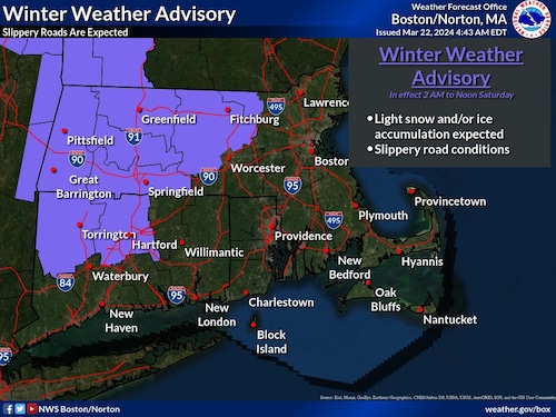
A National Weather Service map shows where a winter weather advisory covers. Slippery road conditions are expected in these areas on Friday night into Saturday morning. (National Weather Service graphic)National Weather Service graphic
A map of Massachusetts displays a winter weather advisory taking place across Central and Western Massachusetts, labeled in purple.
Further, ice accumulation will develop in some regions of Berkshire County, according to the National Weather Service.
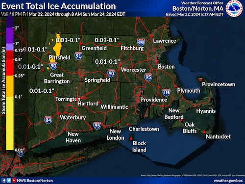
A National Weather Service map showing potential ice accumulations during a weekend storm.National Weather Service
The accumulation will be up to a quarter of an inch of ice, which can bend tree limbs. Limbs often begin breaking at a half an inch of accumulation, according to the National Weather Service.


