

A major winter storm is headed for the bottom of New England on Friday night, threatening up to 8 inches of snow for some parts of Massachusetts.
Forecasters are warning against travel, with expectations of low visibility overnight and into Saturday during the day.
But the storm isn’t going to hit each part of Massachusetts equally. Here’s five maps that show what to expect.
Total Snow Accumulations

Forecasters predict every part of Massachusetts will receive at least an inch of new snow by Saturday night, with some parts receiving more.
The Berkshires and parts of Western Massachusetts have the chance to see between five and eight inches of snow. Central Massachusetts may also be hit hard, with up to five inches in some parts.
Eastern Massachusetts and Cape Cod should only receive a dusting of snow by 7 p.m. on Saturday, according to the National Weather Service (NWS).
High to Low End Snowfall Chances
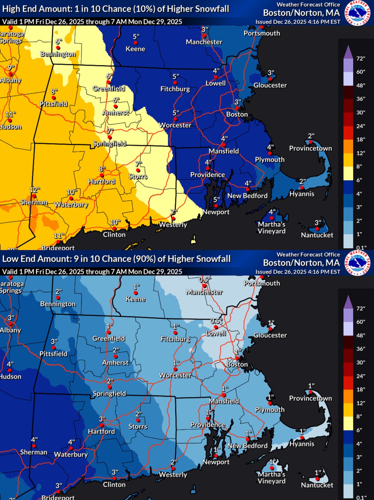
All of the state is projected to receive at least one inch of snow overnight into Saturday.
Areas like Pittsfield will receive at least three and could see up to eight inches, according to NWS maps.
While most of Eastern Massachusetts will top out between three and four inches at the most, some parts of Central Massachusetts may see up to five or six.
What time will the snow start?
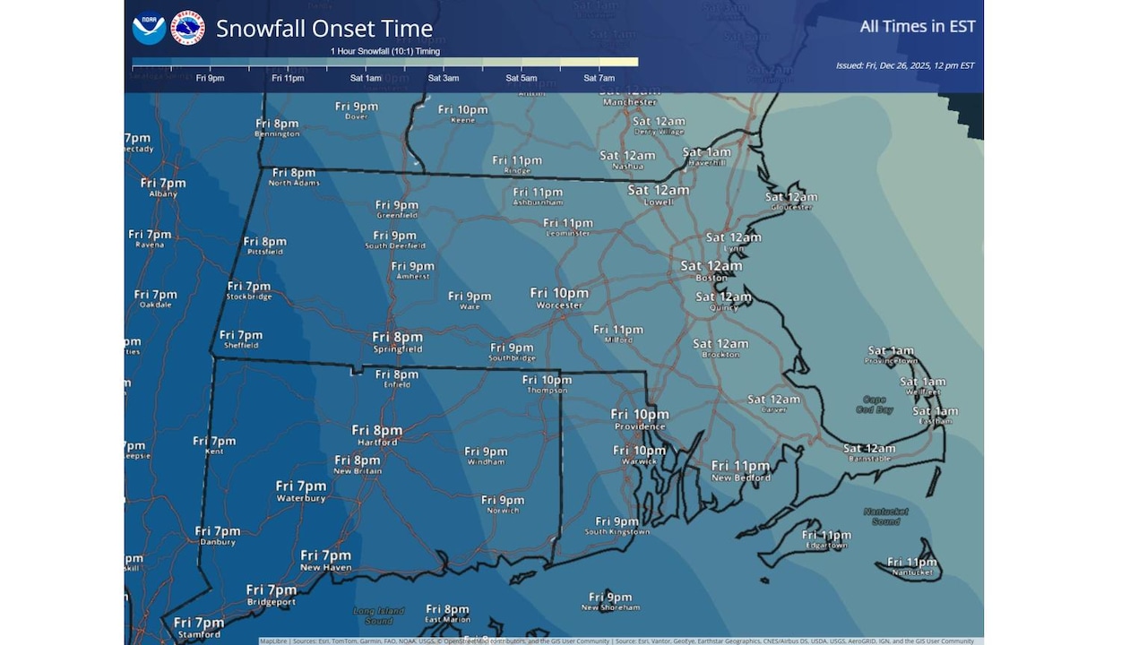
While warnings from the National Weather Service have taken effect as of 4 p.m. across the state, the snow isn’t expected to start until 7 p.m. at the earliest in The Berkshires on Friday.
Flakes will move to the rest of Western Massachusetts by 8 p.m., spread to Central Massachusetts by 9 and 10 p.m., then finally hit Eastern Massachusetts by midnight.
Will the snow be wet or dry?
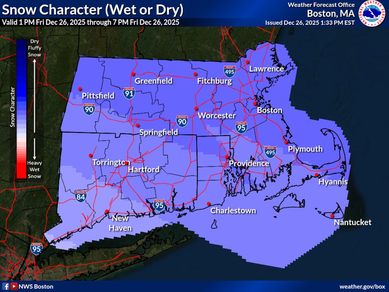
The end-of-year snowstorm will be right down the middle.
Forecasters predict the snow “character,” or the type that will fall, will be right in the middle of “heavy, wet snow” and “dry, fluffy snow.”
These conditions are expected to be the same throughout the state, with slightly fluffier snow in higher altitudes of the state.




