Whether it was an endless string of powerful rainstorms that flooded the state, a powerful nor’easter that dumped three feet of snow on some communities or that time there were five different tornados on a single day in New England, 2023 dished out some extreme weather.
With some help from the National Weather Service, here are the six craziest weather events of the past year.
A record-setting Arctic blast — February 3-4
It gets cold in Massachusetts, but at least on record it has never gotten colder than it did on February 3 or 4 than it did in 2023.
Boston saw temperatures of 8 degrees below zero on Feb. 3 and minus 10 on Feb. 4. In Worcester, it got even colder — minus 10 on Feb. 3 and minus 13 on Feb. 4. Each of those set records for those dates, with the previous records in Boston being 5 degrees below zero on Feb. 3, 1881, and 2 degrees below zero on Feb. 4, 1886.
Boston hadn’t recorded a temperature of 10 below zero since January 15, 1957, when it had a temperature of minus 12 degrees, according to the National Weather Service.
Wind made the cold snap feel even worse. Wind gusts recorded as high as 78 mph in Easthampton and 60 mph in Worcester caused wind chill values as low as 46 degrees below zero.
Wind chill is what the air temperature “feels like to the human skin due to the combination of cold temperatures and winds blowing on exposed skin,” the National Weather Service says.
MassLive compiled a list of how cold it felt in each Mass. community on Feb. 3-4.
Nor’easter dumps 2 feet of snow on Mass. — March 13-15
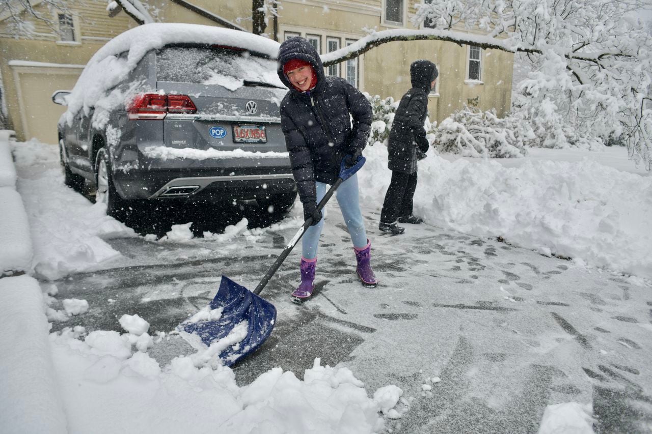
Well into March, when the clocks had already changed and spring was right around the corner, the winter of 2023 came roaring back with the largest snowstorm of the year.
While many communities saw two feet of snow or more, the community with the highest snowfall total — East Hawley — topped three feet, with 37 inches.

Elle Dolan, 11, smiles as and her mom, Sarah, shovels out cars on Kenwood Avenue in Worcester during the March 14, 2023 nor’easter. (Christine Peterson/MassLive)Christine Peterson
The storm knocked out power to tens of thousands of people and canceled school and other activities for multiple days.
The fastest winds associated with the storm were reported to the National Weather Service in Provincetown on the tip of Cape Cod, with a recording of 58 mph winds.
In areas closer to eastern Massachusetts and Rhode Island, most of the precipitation fell as rain, and some communities got three to four inches of it.
And speaking of rain …
The summer of flash floods and severe storms — July through August

Thunderstorms swept across Massachusetts on Friday, July 21, 2023. Pictured here is storm damage in Deerfield. (Deerfield Police Department)
Remember that stretch of the summer when it rained just about every single weekend? History certainly will.
July 2023 was the wettest July on record in Hartford and the second wettest for Boston, Providence and Worcester, according to the National Weather Service.
Boston saw 10.43 inches of rain; Worcester had 12.3 inches; Providence had 8.37 inches; and Hartford had 13.93 inches, passing its previous record in 1938 of 12.24 inches. Conway, Mass., set its own kind of record, with the highest rainfall total in the U.S., Canada and Puerto Rico at 21.42 inches, according to the National Weather Service.
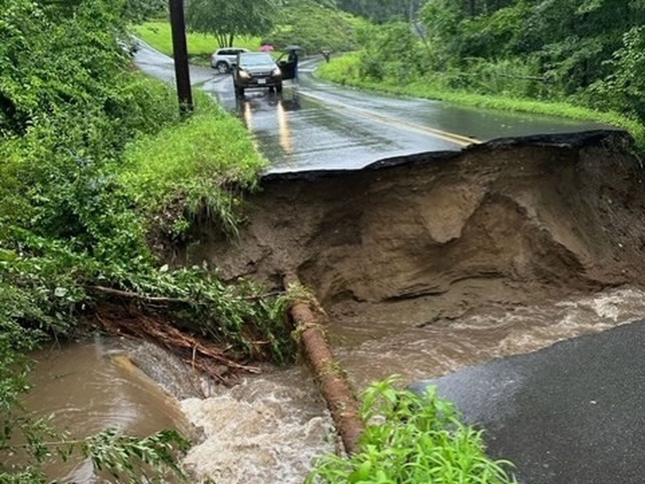
All that rain caused serious damage, particularly to farmers, and Mass. Gov. Maura Healey toured the most devastated areas and said the storms exposed an “infrastructure crisis.” That was on July 12, with many storms still to come.

Governor Maura Healey visits Williamsburg and North Adams to assess damage from flooding.
Later in the month, flash flooding from near-constant rain storms tore up roads, leading one first responder in Deerfield to mount a rescue of a woman who’s car fell into a 12-foot ravine. During that storm, more than six inches of rain fell near Conway and Deerfield, mostly in a period of three to six hours, according to the National Weather Service.
Eastern Massachusetts didn’t escape the flooding, and saw two to three inches fall within an hour.
In August, storms continued, and some were arguably worse for their wind. On August 8, a tornado touched down in Mattapoisett with winds of 95 mph and was on the ground for nearly a mile, according to the National Weather Service. Another tornado hit Barnstable on the same day, with winds of 80 mph.
Two tornadoes was extreme, but not as extreme as …
The day 5 tornadoes formed in southern New England — August 18
In one morning — on Aug. 18, 2023 — five tornadoes struck southern New England.
The first, in Scotland, Conn., had winds of 100 mph and traveled for nearly three miles. The second, in Scituate, Rhode Island, was even faster, at 115 mph, and traveled for more than 9 miles.
The other three were in Massachusetts: a 90 mph tornado in North Attleboro traveled for 7.6 miles, an 80 mph tornado touched down briefly in Stoughton, and the last of the day was in Weymouth with peak winds of 110 mph, traveling about a third of a mile.
The North Attleboro tornado sheared the tops of several large trees, knocked one tree onto a car, and toppled an air conditioning unit estimated to weigh 1,000 pounds, which sat on the roof of a single-floor commercial building.
Hurricane Lee … mostly misses Massachusetts — Sept. 15-16
In Massachusetts, Hurricane Lee became a frequent topic of conversation with many fearing the worst.
For a while, it was looking like Hurricane Lee was going to directly hit Massachusetts, it became clear that the cyclone wasn’t going to touch the state. It’s bark was worse than its bite.
However, strong winds ripped the coast as it swirled by.
Hurricane Lee passed offshore on Sept. 15 and 16 with winds gusting at between 45 and 63 mph and causing tree damage. It was Cape Cod communities that felt Lee the strongest, with the fastest winds being experienced there.


