
Tropical Storm Erin has transformed into a catastrophic Category 5 hurricane and is expected to hit the East Coast next week.
The storm formed in the eastern tropical Atlantic Ocean on Monday and was around 430 miles west-northwest of the Cabo Verde Islands with maximum sustained winds at 45 mph, the hurricane center reported.
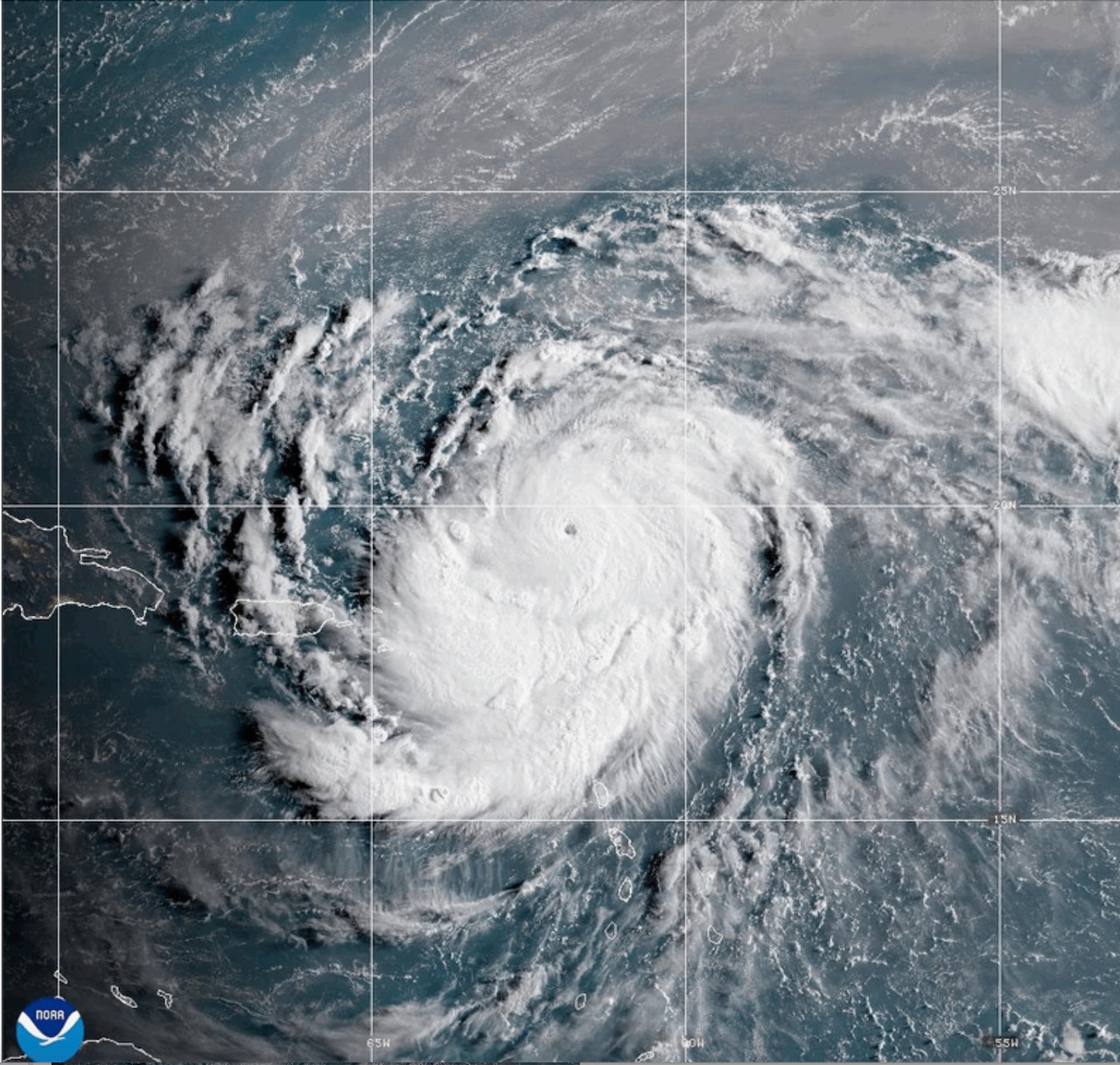
However, the National Weather Service states that Erin is now a Category 5 hurricane after its maximum sustained winds surged to 160 mph.
With that being said, heavy rainfall from Erin is expected to cause flash and urban flooding along with landslides or mudslides on Sunday across the northern Leeward Islands, the Virgin Islands and Puerto Rico.
These locations, in addition to the Turks and Caicos Islands and Southeast Bahamas, could also be hit by powerful wind gusts Saturday night, the National Weather Service predicts.
Additionally, Erin is expected to produce life-threatening surf and rip currents along the beaches of the Bahamas, much of the east coast of the U.S. and Atlantic Canada next week.
“Interests in Bermuda should continue to monitor the progress of Erin since there is a risk of strong winds, heavy rainfall, and high surf by the middle part of next week,” the National Weather Service adds.
If you purchase a product or register for an account through a link on our site, we may receive compensation. By using this site, you consent to our User Agreement and agree that your clicks, interactions, and personal information may be collected, recorded, and/or stored by us and social media and other third-party partners in accordance with our Privacy Policy.


