It’s certainly raining cats and dogs and then some in Massachusetts, with excessive rainfall and thunderstorms bringing the possibility of flooding and lightning to the commonwealth Saturday.
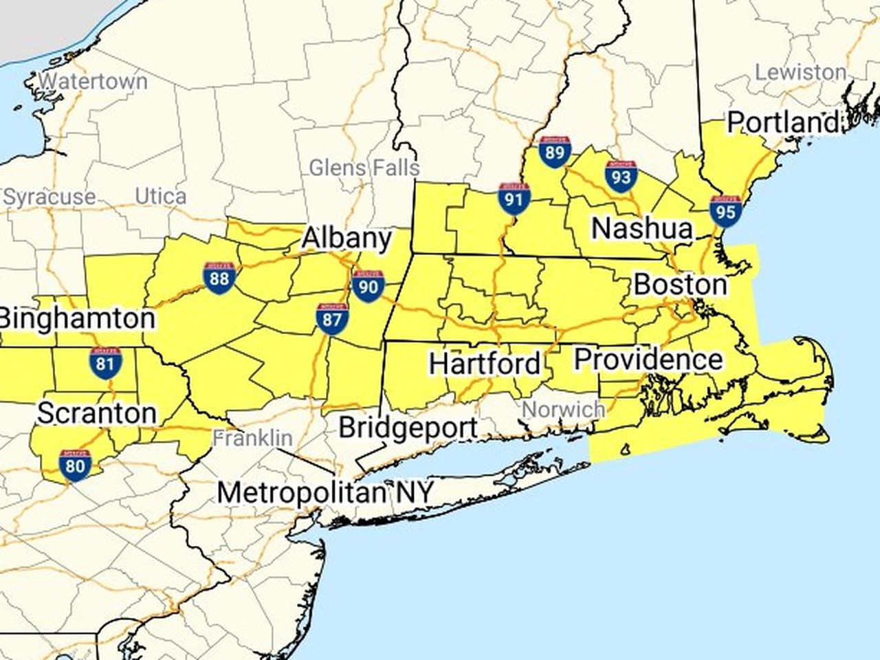
The National Weather Service issued a severe thunderstorm watch Saturday afternoon for the entire state as well as parts of Connecticut, Maine, New Hampshire, New York, Pennsylvania, Rhode Island and Vermont that is expected to last until 9 p.m. The federal forecasting agency warned of the possibility of isolated hail up to a quarter in size, scattered wind gusts up to 70 miles per hour and frequent lightning in the region.
“A Watch means conditions are favorable for severe thunderstorms,” the Weather Service said in a social media post. “Pay close attention to changing weather through this evening and listen for any Warnings we might issue when severe storms are actually occurring in your area.”
A more serious flash flood warning that is expected to last until 3 p.m. was issued for parts of Eastern Massachusetts as well, including areas in Middlesex, Norfolk and Suffolk counties. A weather radar indicated thunderstorms were producing heavy rainfall that may cause flash flooding in Belmont, Boston, Brookline, Cambridge, Chelsea, Dedham, Everett, Hull, Milton, Needham, Newton, Quincy, Revere, Somerville, Waltham, Watertown, Wellesley, Weston and Winthrop.
Forecasters warned people to turn their vehicles around when they encounter flooded roads and be aware of their surroundings.
“Between 1 and 2 inches of rain have fallen. The expected rainfall rate is 1 to 2 inches in 1 hour,” the Weather Service said in its warning. “Additional rainfall amounts of 0.5 to 1 inch are possible in the warned area. Flash flooding is ongoing or expected to begin shortly.”
A severe thunderstorm warning, which is also more serious than a watch, was also issued for parts of southeastern Massachusetts. A severe thunderstorm over Scituate is moving southeast at 20 mph. Wind gusts of 60 mph are expected, and damage to trees and power is possible, according to the Weather Service.
“For your protection move to an interior room on the lowest floor of a building,” the Weather Service recommended.
Earlier, the Weather Service issued a flood watch for nearly all of Massachusetts that was expected to last from 11 a.m. through Saturday evening. Forecasters warned significant rainfall may trigger flooding in low-lying areas and locations with poor drainage. Excessive runoff could also result in sharp rises in water levels at rivers, creeks and streams.
Thunderstorms capable of heavy rainfall are expected to become more frequent after 4 p.m. and into the early evening, the Weather Service noted.
“You should monitor later forecasts and be alert for possible Flood Warnings,” the Weather Service said. “Those living in areas prone to flooding should be prepared to take action should flooding develop.”
As the cold front causing the thunderstorms dissipates, a more comfortable airmass will move into the state Sunday and remain in place through much of next week, according to the Weather Service. The forecast is subject to significant change more than 72 hours out.