It may be unseasonably warm Tuesday afternoon, but cold weather might bring snow to some parts of Massachusetts Wednesday night into Thursday, according to the National Weather Service.
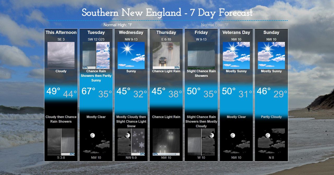
Tuesday’s forecast starts out cloudy and rainy before temperatures reach the mid-to-upper 60s by the afternoon, the weather service said. Tuesday will also be the warmest day of the week.
Then, despite these above normal temperatures, a cold front will sweep across the region Tuesday night. The front is expected to bring wind gusts between 20-25 mph, possible 30 mph in higher terrain areas of the Berkshires and Worcester County, forecasters said.
Temperatures are expected to fall into the low 30s in these areas as well.
Forecasters believe these frigid temperatures appear cold enough “to support a period of wintry precipitation that could come in the form of sleet, ice pellets or snow.”
The weather service also said snow could cover “higher elevations of The Berkshires and The Worcester Hills” Wednesday and into Thursday.
“Some snow or mixed precipitation is possible late Wednesday night and early Thursday across interior southern New England as low pressure moves into the region,” the weather service said in a statement.
“Mostly sunny conditions are expected for Wednesday, although it will be blustery with temperatures running 5 to 10 degrees cooler than normal,” the statement continued.
As of Tuesday morning, less than a inch of snowfall is expected. Most areas outside Central and Western Massachusetts will most likely only get rain, according to the weather service.
Any remaining wintry precipitation will switch over to rain Thursday. Slightly below temperatures are expected for the rest of the week, while drier and colder weather returns next weekend, forecasters said.


