Snow is expected across the state on Tuesday, but snow totals are expected to be modest, according to the National Weather Service.
In a message on X, formerly known as Twitter, on Tuesday morning, the National Weather Service predicted light snow developing late in the afternoon into evening.
According to a weather map released by the National Weather Service snow will develop between 4 p.m. and 10 p.m. on Tuesday. Snow accumulations are expected to be between 1 and 2 inches across the state, with as much as 3 inches on the western half of the Interstate-91 corridor. Most of Cape Cod is expected to get less than an inch of snow.
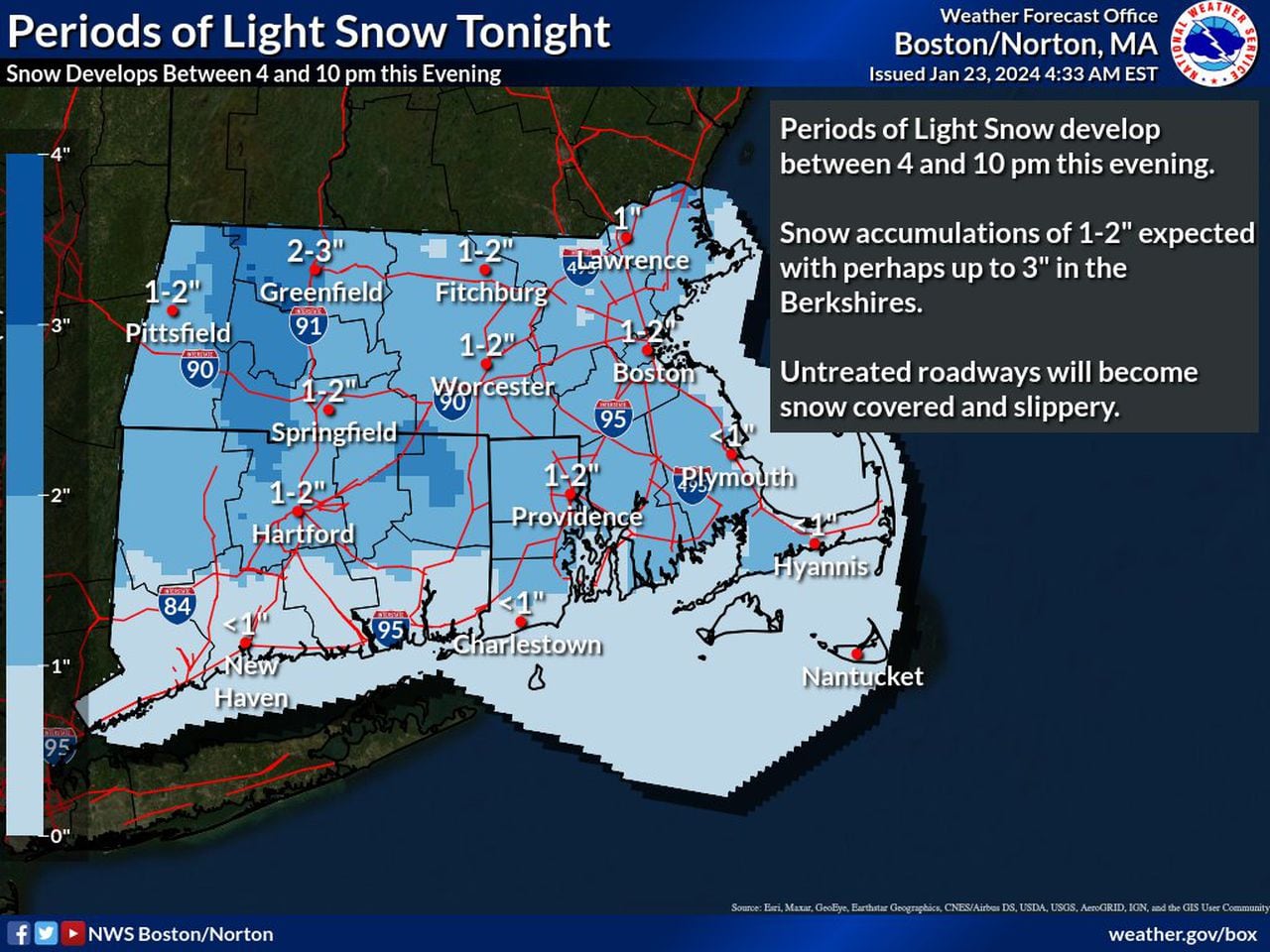
Snowfall is expected to be modest in Massachusetts, with the highest totals expected near the Berkshires at 3 inches. (National Weather Service map)National Weather Service map
On Wednesday there will be pockets freezing rain in the western and central portions of the state.
Rainfall amounts are expected to be low — less than a tenth of an inch — but the Weather Service warns that untreated roadways may be covered in ice, especially in higher elevations.
Western Connecticut is also expected to receive freezing rain, the Weather Service predicted.
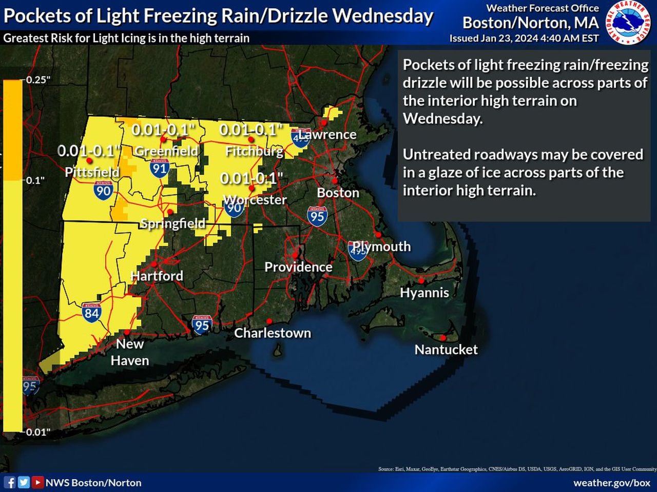
Freezing rain may develop in Western and Central Massachusetts, as well as in parts of Connecticut. (National Weather Service map)National Weather Service map
From Tuesday evening through Wednesday, there is a winter weather advisory in effect for areas with higher elevation. Western Connecticut and Massachusetts, and most of Central Massachusetts, is affected by the advisory for a combination of snow accumulation on Tuesday night and pockets of light freezing rain on Wednesday.
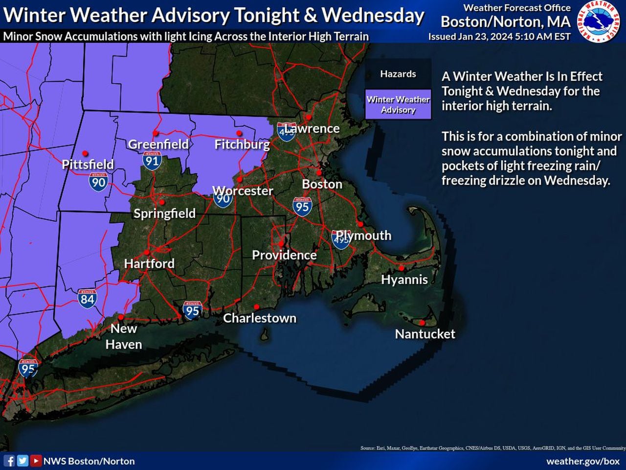
A winter weather advisory is in effect for Tuesday and Wednesday evening in the purple areas. (National Weather Service map)National Weather Service map
There’s one more unexpected twist in this week’s weather. A potential hot day for January.
The National Weather Service predicts that there’s a significant chance temperatures will rise above 50 degrees on Friday for much of the state. According to a map released earlier this week, Springfield, Worcester and Lowell all have a 30-40% chance of seeing 50 degrees on Friday with Boston having a 40-50% chance.
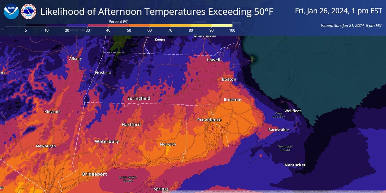
The National Weather Service predicts a potential warm day on Friday — for January. (National Weather Service map)National Weather Service map
A chunk of southeastern Massachusetts has as much as a 60% chance of getting to that 50-degree mark, according to the National Weather Service.


