
The National Weather Service issued a flash flood warning for parts of Massachusetts as the chances of rain and more thunderstorms could douse the Bay State going into the evening on Monday.
Central Franklin and Hampshire counties are under the state’s flash flood warning, with torrential heavy rain spotted at around 4:57 p.m., the warning stated.
Areas that could be hit by flash flooding include Holyoke, Amherst, Northampton, South Hadley, Easthampton, Belchertown, Granby, Southampton, Hadley, Sunderland, Hatfield, Williamsburg, Shutesbury, Westhampton, Whately and Pelham.
Forecasters noted that the timeframe where potentially severe weather could be spotted is between 2 and 10 p.m.
This warning should remain in effect until 6 p.m.
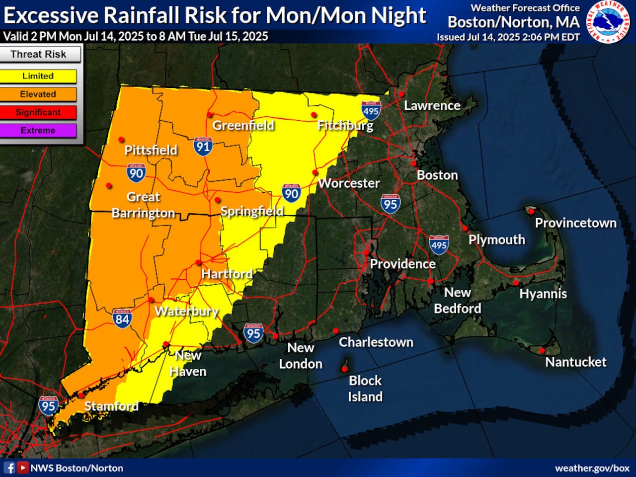
Additionally, a flash flood watch continues to be in effect for western and eastern Franklin, western and eastern Hampshire and western and eastern Hampden counties. This watch — in effect until later Monday night — warns that excessive runoff could cause rivers, creeks and streams to flood, along with causing waters to rise in urban areas.
“Creeks and streams may rise out of their banks,” the flash flood watch read. “Flooding may occur in poor drainage and urban areas.”
Outside of these areas that could see excessive rain and possible flooding, forecasters anticipate rainfall totals to be between 1 and 3 inches.
Rain activity should wane by Tuesday morning, though the heat advisory should go back into effect by 11 a.m. and will be in effect until 7 p.m. Thursday, covering the whole state with the exception of the Cape and Islands. Forecasters warn that heat index values of 95 and 100 could appear in the afternoons, with the worst heat likely appearing on Wednesday and Thursday. There’s a chance the advisory could be extended for Friday.
Heat indices on Tuesday could leave some communities feeling like it’s close to 100 degrees, including Lowell, feeling like 96 degrees or Springfield, feeling like 98. Conditions could feel hotter during the week, with Brockton feeling like 98 and 99 degrees on Wednesday, Thursday and Friday, for example, according to the weather service on X.
By Tuesday afternoon, highs should reach the high 80s and low 90s, forecasters said. These conditions should continue to be present for the next couple of days before conditions possibly get warmer. But by the end of the week, forecasters said worsening heat and humidity could lead to more showers and storms, with moisture levels potentially contributing to another flash flood risk.
If you purchase a product or register for an account through a link on our site, we may receive compensation. By using this site, you consent to our User Agreement and agree that your clicks, interactions, and personal information may be collected, recorded, and/or stored by us and social media and other third-party partners in accordance with our Privacy Policy.


