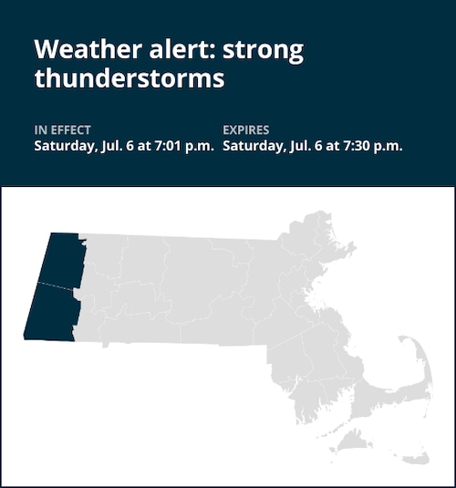
A weather alert was issued by the National Weather Service on Saturday at 7:01 p.m. for strong thunderstorms until 7:30 p.m. for Berkshire County.
Residents can be ready for wind gusts of up to 40 mph.
“At 7:01 p.m., Doppler radar tracked a strong thunderstorm near Austerlitz, or 8 miles east of Chatham, moving east at 30 mph,” states the weather service. “Gusty winds could knock down tree limbs and blow around unsecured objects.”
Locations impacted by the alert include Pittsfield, Chatham, Lee, Lenox, New Lebanon, Becket, Austerlitz, Berkshire, Dalton, Ghent, Hinsdale, Stockbridge, Canaan, Richmond, West Stockbridge, Windsor, Peru, Washington, Barkerville and Glendale. People attending Tanglewood should seek safe shelter immediately!
The weather service adds, “If outdoors, consider seeking shelter inside a building. Torrential rainfall is also occurring with this storm and may lead to localized flooding. Do not drive your vehicle through flooded roadways. This storm may intensify, so be certain to monitor local radio stations and available television stations for additional information and possible warnings from the National Weather Service.”
Staying safe as lightning approaches: Expert advice
Each year, lightning strikes the United States approximately 25 million times, with the majority of these electrifying events occurring during the summer months. Unfortunately, lightning is responsible for claiming the lives of approximately 20 people annually, as reported by the weather service. The threat of lightning becomes more pronounced as thunderstorms draw nearer, peaking when the storm is directly overhead and gradually waning as it moves away.
To guarantee your safety in the midst of a thunderstorm, take into account the following recommendations:
Lightning safety plan:
- When venturing outdoors, it’s vital to establish a clear plan for seeking shelter in case of lightning.
- Monitor the sky for threatening signs and listen for the sound of thunder. If thunder is audible, it’s an indication that lightning is nearby.
- Seek a safe place to shelter, preferably indoors.
Indoors safety measures:
- Once you’ve found shelter indoors, abstain from using corded phones, electrical appliances, or plumbing fixtures, and refrain from approaching windows and doors.
- Lightning can follow conductive pathways, and these precautions reduce the risk of electrical surges.
Wait for the all-clear:
- After the last lightning strike or thunderclap, wait at least 30 minutes before resuming outdoor activities.
- It’s important to remember that lightning can strike even when a storm seems to have passed, so exercise caution.
When indoor shelter isn’t available:
If you find yourself outdoors without access to indoor shelter during a thunderstorm, take these steps to maximize your safety:
- Avoid open fields, hilltops, or ridge crests, as they expose you to greater lightning risk.
- Steer clear of tall, isolated trees and other prominent objects. In forested areas, stay close to lower stands of trees.
- If you’re in a group, ensure that individuals are spaced out to prevent lightning current from transferring between people.
- Camping in an open setting during a thunderstorm is strongly discouraged. If you have no alternative, set up camp in a valley, ravine, or other low-lying areas. It’s crucial to note that a tent provides no protection against lightning.
- Do not approach water bodies, wet objects, or metal items. While water and metal don’t attract lightning, they conduct electricity effectively and can pose significant risks.
In summary, when facing the threat of lightning, preparedness and vigilance are your best allies. By following these guidelines, you can significantly reduce the likelihood of lightning-related incidents and prioritize your safety.
Mastering wet roads: Safety tips for heavy rainfall
When heavy rain strikes, safety is paramount. Equip yourself with these guidelines from the weather service to navigate wet roads and avoid hazards:
Beware of rapid water flow:
During heavy rain, avoid parking or walking near culverts or drainage ditches, where swift-moving water can pose a serious risk.
Maintain safe driving distances:
Use the two-second rule to maintain a safe distance from the car in front of you and allow an extra two seconds in heavy rain.
Reduce speed and drive cautiously:
On wet roads, reducing your speed is crucial. Ease off the gas pedal gradually and avoid abrupt braking to prevent skidding.
Choose your lane wisely:
Stick to the middle lanes to minimize the risk of hydroplaning. Outer lanes are more prone to accumulating water.
Prioritize visibility
Turn on your headlights and be careful of other vehicles to the rear and in blind spot areas as they are especially difficult to see through rain-spattered windows.
Watch out for slippery roads:
The initial half-hour of rain is when roads are slickest due to a mixture of rain, grime, and oil. Exercise heightened caution during this period.
Keep a safe distance from large vehicles:
Don’t follow large trucks or buses too closely. The spray created by their large tires reduces your vision. Take care when passing them as well; if you must pass, do so quickly and safely.
Mind your windshield wipers:
Overloaded wiper blades can hinder visibility. If rain severely impairs your vision, pull over and wait for conditions to improve. Seek refuge at rest areas or sheltered spots.
When stopping by the roadside is your only option, position your vehicle as far off the road as possible, ideally beyond guardrails. Keep your headlights on and activate emergency flashers to alert other drivers of your position.
By following these safety measures, you can significantly reduce risks and ensure your well-being when heavy rain pours down. Stay informed about weather conditions and heed advice from local authorities to make your journey safe and sound.
Advance Local Weather Alerts is a service provided by United Robots, which uses machine learning to compile the latest data from the National Weather Service.